
What is Crucible Heightmap?
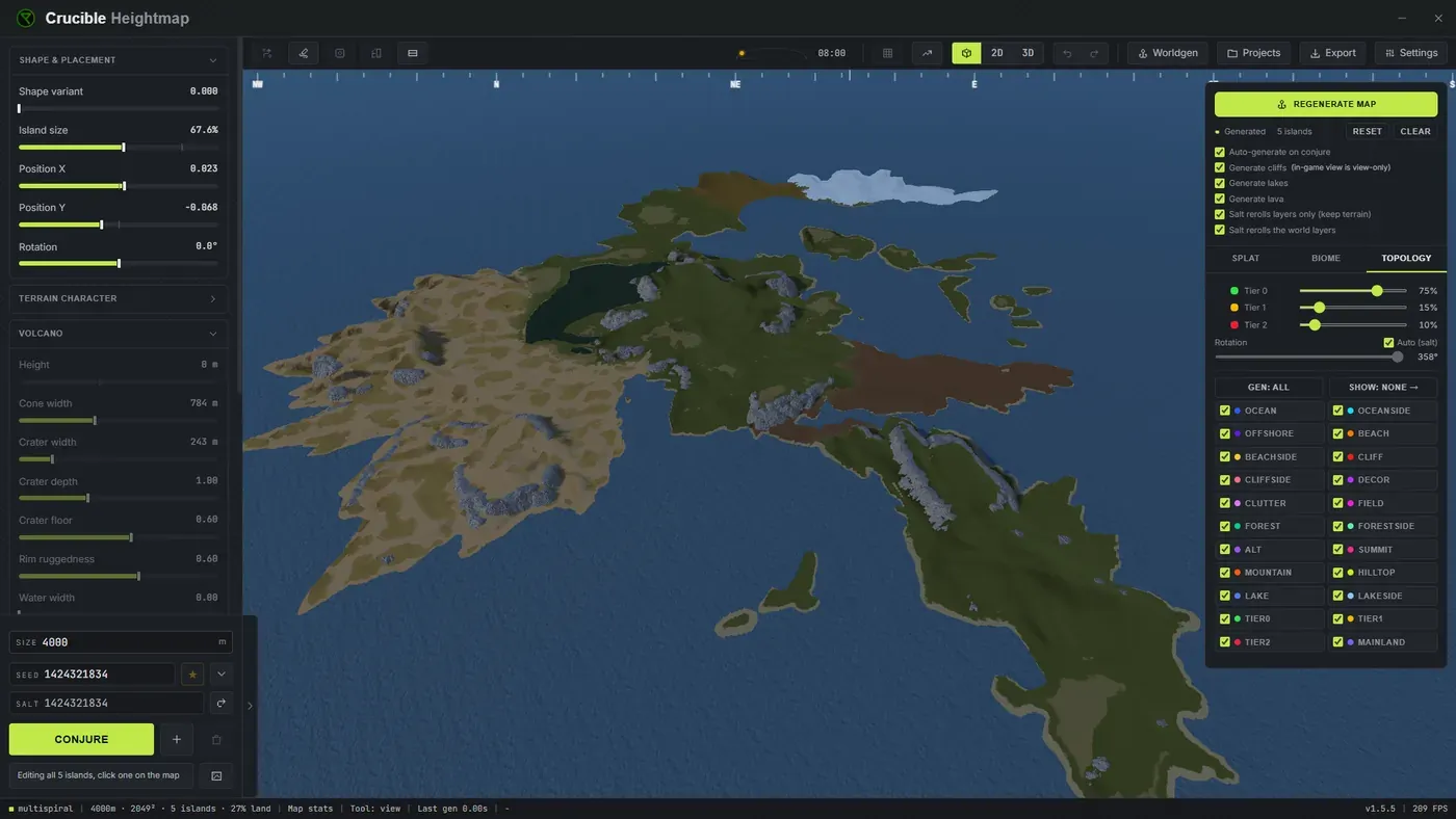
Crucible Heightmap is a Rust map generator for Windows, built for Rust map makers who want custom island terrain fast. It exports a ready-to-open Rust .map file, a whole world in one file, that opens straight in RustEdit, the community map editor for Rust, so you can build a custom map in minutes instead of hand sculpting terrain for hours. It’s purpose-built for Rust server admins and far simpler than professional game dev tools: no programming or 3D modeling skills required.
What it does
Section titled “What it does”- Generates procedural custom island terrain tuned for Rust’s own proc gen, so beaches, slopes and cliffs feel natural in game.
- Rolls islands from eight island styles you pick from: Classic, Spine, Fingers, Harbour, Highland, and the three cone styles Volcano, Crater and Caldera. A style sets the coastline, the mountains and the relief together, so each one is a different kind of island rather than a different blob.
- Combines multiple island seeds into one complex map, up to 48 islands, in eight map-style families including volcanic chains and Galapagos island groups.
- Generates the whole Rust world from your terrain: biomes (Arid, Temperate, Tundra, Arctic and Jungle), all of Rust’s topology layers, a biome-tinted ground texture, lakes as real water bodies, and lava in a volcano’s vent.
- Places Rust’s real cliff and rock models on the steep ground and bakes them into the map.
- Includes nine sculpting brushes (raise, lower, flatten, smooth, bench, terrace, bluff, pucker and ripple), with stamp shapes, symmetry and full undo and redo.
- Lets you draw an island shape by hand or import a picture of one, and build the map around it, as one island or as a whole archipelago.
- Cuts water channels clean across a finished map, and inlets into its coast, rolled or drawn by hand.
- Paints Rust ground textures (dirt, sand, rock, grass, forest, snow, stones and gravel) straight onto your islands, with soft blending between them.
- Lets you paint biomes and topology by hand wherever you want to overrule the generator.
- Shows a live 2D and 3D preview as you shape your terrain, plus an in-game view with real Rust textures, cliffs and lakes, so you can see the finished world before you export.
- Shows a colored map with the in-game grid, and a slope view, to check spacing and steepness before you export.
- Exports a full Rust
.mapfile carrying your terrain, ground textures, biomes, topology, lakes, lava and cliffs, that opens directly in RustEdit in one step. - Exports 16-bit grayscale .raw for RustEdit, plus .png for previews and sharing.
- Exports your painted ground textures straight into RustEdit through its World Creator panel, and saves a full-color textured .png of the finished map.
- Saves projects and shareable
.hmseedseed files. - Autosaves as you work, so you never lose a map.
How it fits the map making workflow
Section titled “How it fits the map making workflow”A heightmap is the terrain skeleton of a Rust map: a grayscale image where brightness equals elevation. The pipeline is:
- Generate terrain in Crucible Heightmap.
- Export it as a Rust
.mapfile, or as a 16-bit .raw heightmap. - Open the
.mapdirectly in RustEdit, or import the .raw as your terrain. - On the
.rawroute, run RustEdit’s procedural generation to add cliffs, topology, biomes and ground textures. A.mapalready carries all of that, so leave the topology passes off there or they reset what the file brought with it. - Place monuments, roads and prefabs on top, by hand or procedurally, to finish the map.
Crucible Heightmap installs through the Crucible launcher, and you can test your finished map locally with the free Crucible Local Server app.
Map sizes
Section titled “Map sizes”Crucible matches RustEdit’s heightmap resolutions exactly: 513, 1025, 2049 and 4097. The map size you pick sets the export resolution.
Get the Heightmap App
Section titled “Get the Heightmap App”Download and pricing are on the Crucible Heightmap page.