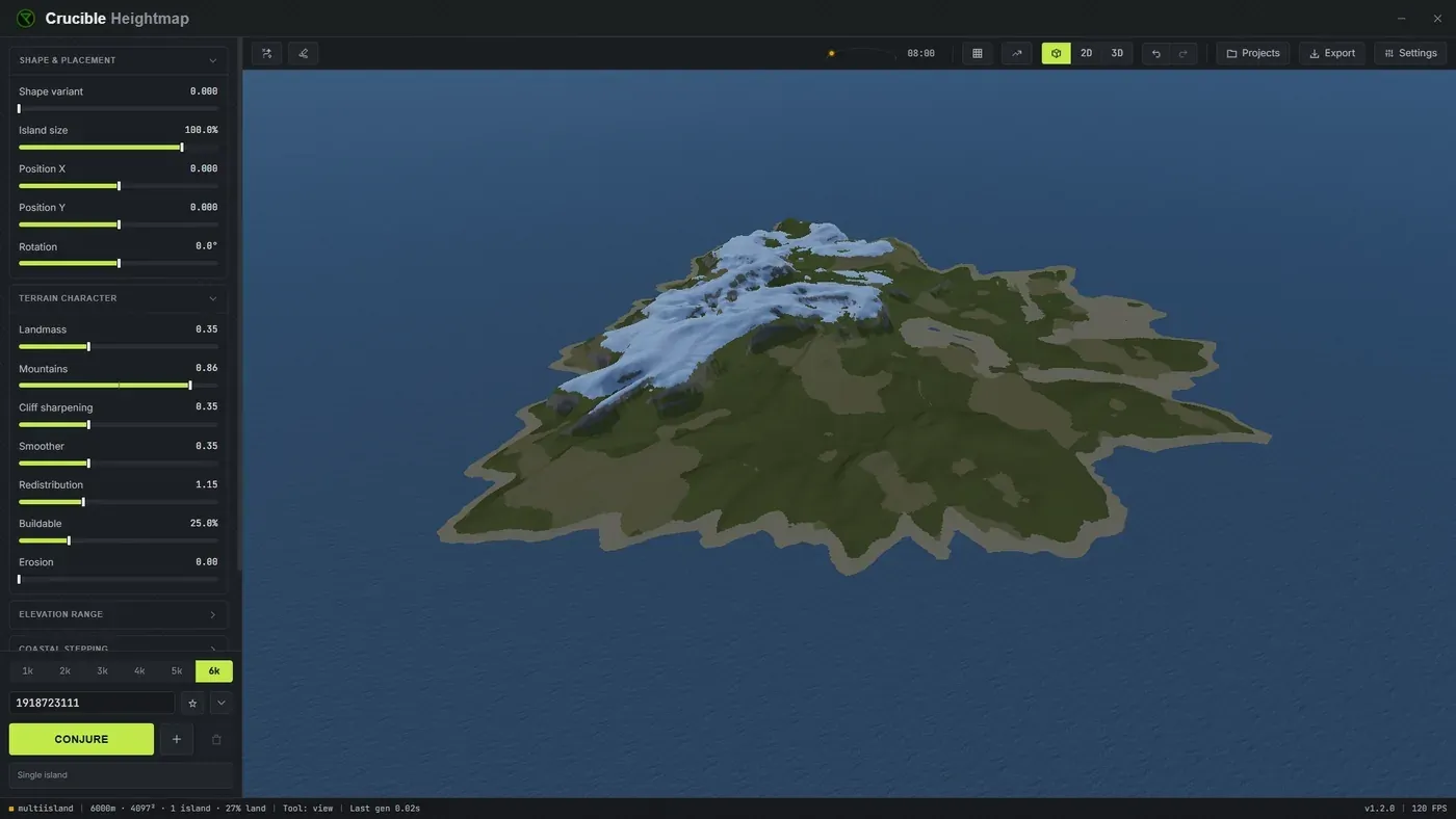
Live 3D preview
Crucible shows your terrain in a live 3D preview that updates instantly as you adjust sliders or brush the terrain. You read elevation, coastline shape and terrain features as you work, instead of guessing from a flat grayscale image, and see how your map will look before you export it into RustEdit.
What views and overlays are there?
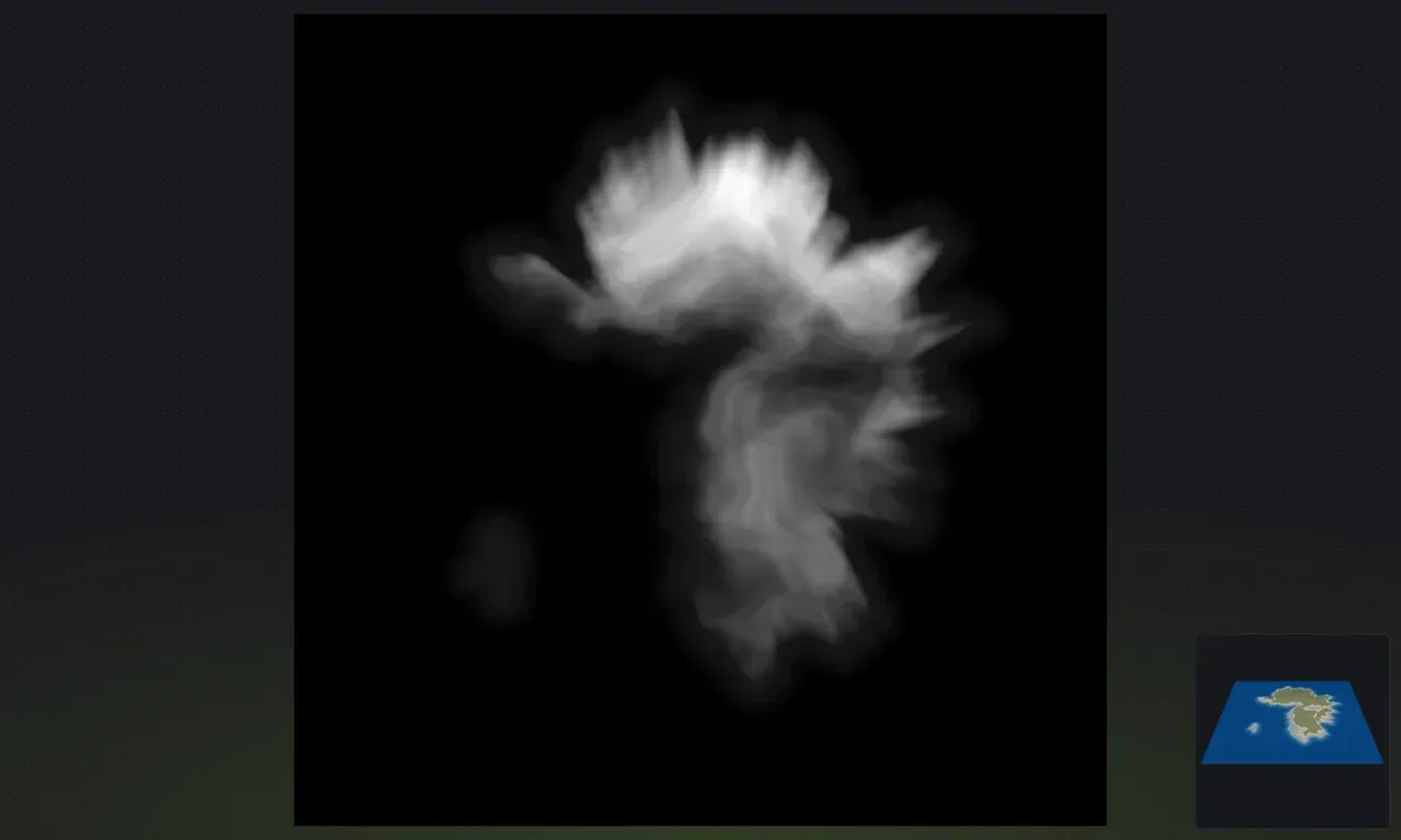
Section titled “What views and overlays are there?”- 3D and 2D: toggle between a shaded 3D view of your terrain (shows how it generally looks in game) and a flat 2D heightmap view (the raw 16-bit grayscale image). Use 3D to evaluate shape and lighting, use 2D to check pixel-precise elevation values.
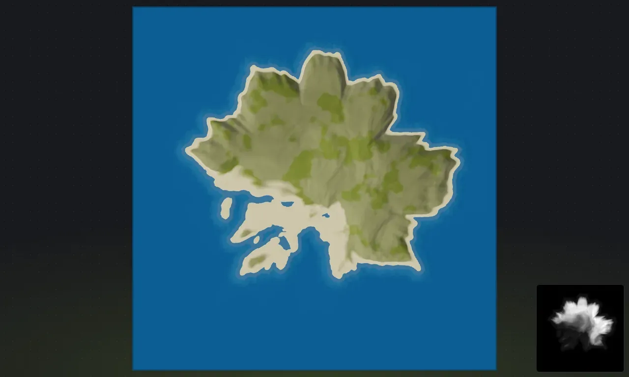
- In-game view: a third view that renders your island much closer to how it looks in Rust, with real ground textures, water and sky, and a fly camera. See in-game 3D view.
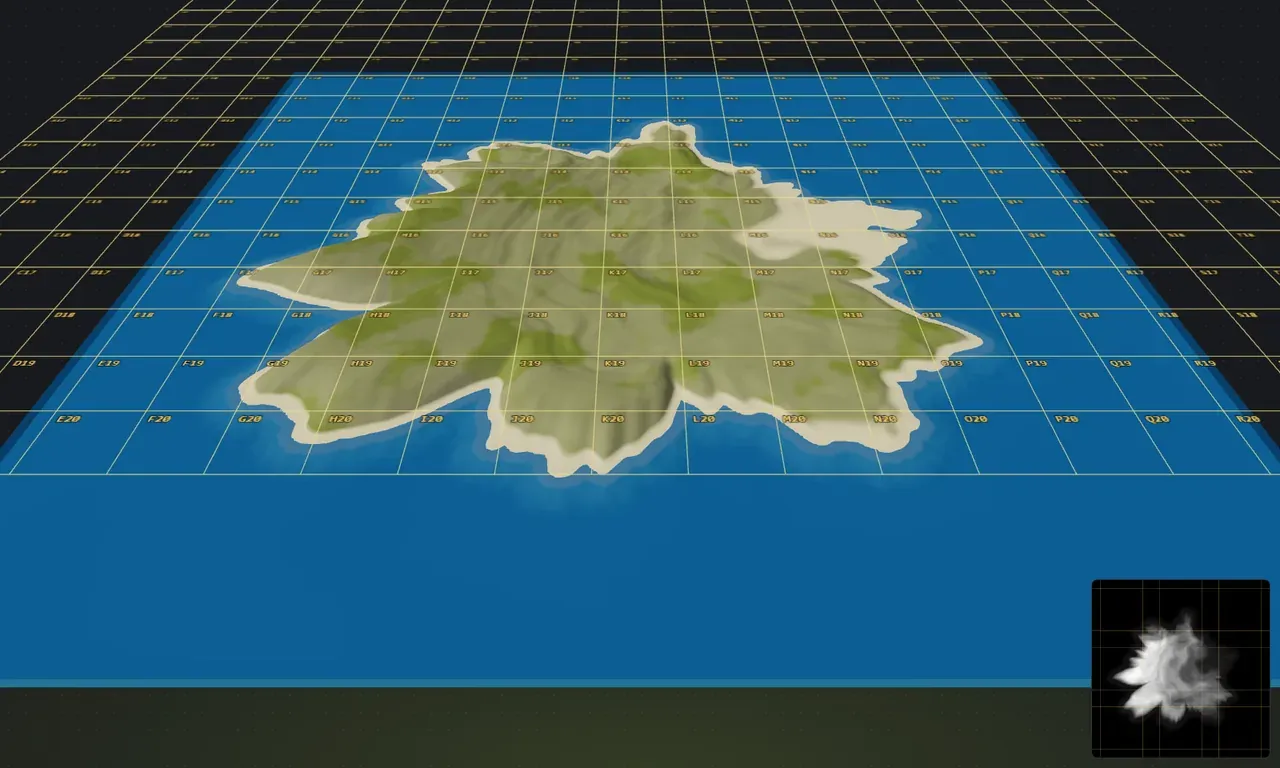
- Grid overlay: see your map laid out against the same map grid you get in game, with matching cells and grid letters (A0 in the top-left corner). Useful for understanding map scale and planning exactly where terrain features will sit on the in-game map. Turn it on when planning monument placement before RustEdit.
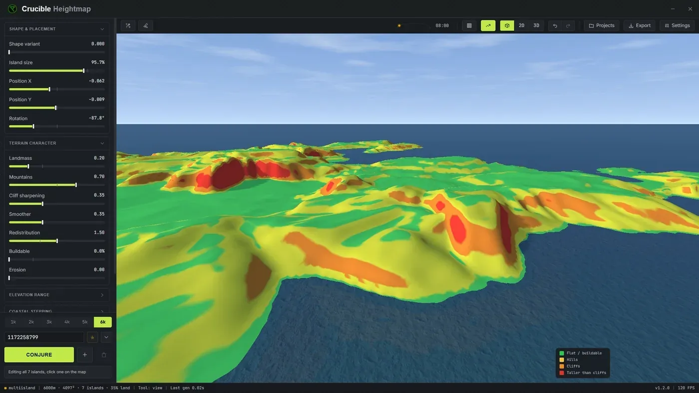
- Slope view: color-codes the terrain by how playable it is: green is flat, buildable ground, yellow is hilly terrain, orange marks cliffs, and red marks ground taller than cliffs (too extreme for the game to decorate naturally). A color key beside the minimap labels each band, and the overlay hides itself again when you turn it off. Use it to spot cliffs, verify buildable ground distribution, plan base locations, and catch terrain you may want to soften before building on it.
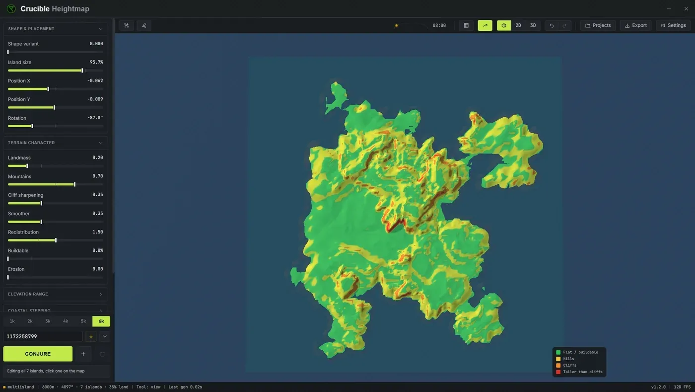
- Sun and time: change the light angle and sun position to preview how slopes and cliffs will shade in game. Helps you evaluate visual contrast and read the terrain better.
- Minimap: a small floating overview showing your whole map as a secondary view.
- Top-down view: press T to snap the camera straight overhead for a clean, map-wide look (Reset view, R, brings the normal angle back; both rebindable in Settings). Handy for planning layout and reading the whole island at once.
The 3D preview also colors your terrain the way Rust does: grass lowlands, grey rock on the steep cliff faces, snow on the peaks and scattered forest in the grass. Each island is tinted by the base surface you choose, and any ground textures you paint show up here live as you work.
The preview updates as you move sliders or combine islands, so you shape the map with immediate feedback before you export. See Status bar for info on the indicators shown at the bottom of the workspace.