Draw or import a custom island shape
Crucible Heightmap can generate an island for you, and it can also build a map around an outline you decide. Draw one by hand in the app, or import a picture of one, and the shape becomes a real island: terrain, a coastline, beaches, biomes and splats, lakes and cliffs, the same as any island Crucible rolls itself.
That makes it the fastest way to build a Rust map with a specific silhouette: a logo, a country, a layout you sketched on paper, or a map shape you have had in your head for a while.
Open the shape panel
Section titled “Open the shape panel”Press 4, or click the picture button on the right of the island strip in the Generator sidebar, next to the add and delete island buttons.
The panel opens on Draw a shape. The other tab, Use an image, imports a file instead.
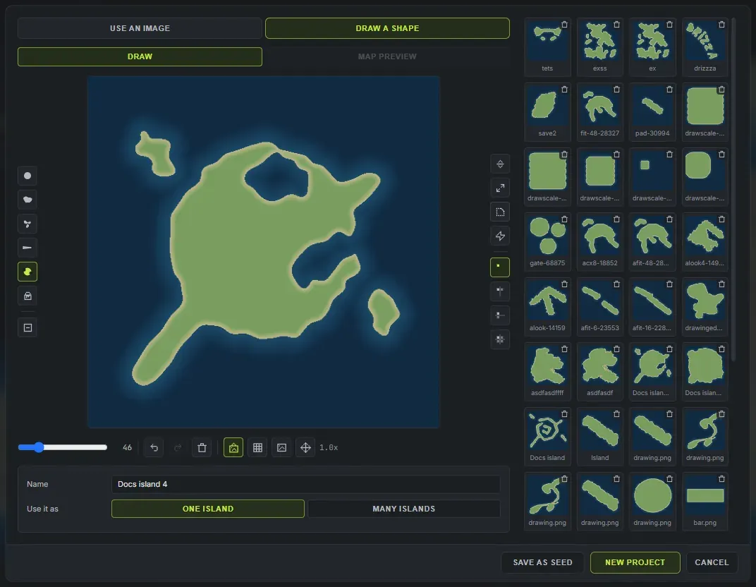
The square in the middle is the island. It is drawn the way the map will read it: land, a sand rim, and open water around it, updating as you paint. The brushes sit in the rail on its left and the coastline tools in the rail on its right, so the square itself stays as big as the window allows.
The brushes
Section titled “The brushes”These are not general drawing tools. Each one lays down the kind of land a coastline is actually made of.
- Round is a plain brush, for blocking a body in quickly.
- Coast lays land with a broken, natural shoreline. This is the one to build the main island with, because a single drag already gives you headlands and inlets instead of a smooth edge.
- Blobs scatters islands and headlands as you drag. Good for an archipelago, or for a few islets off the coast.
- Spit starts at full width and tapers as you drag, so one stroke gives you a peninsula or a sand spit that narrows to a point.
- Coves bites bays and inlets out of the coast. It always removes land, whatever the erase toggle is set to.
- Fill floods an area with land, or with sea while erasing.
Erase turns any brush into its opposite, so the same coast brush that lays land also carves it away.
Shaping the whole coastline
Section titled “Shaping the whole coastline”The right-hand rail works on the entire outline at once, which is far quicker than trying to brush it by hand:
- Grow and Shrink push the coastline out or pull it in everywhere.
- Smooth rounds the shoreline off. It is a small step on purpose, so you can repeat it until it looks right.
- Roughen makes the coast irregular again, with a different result every press.
Under those, the mirror buttons repeat everything you draw across one axis or both, which is how you get a symmetrical island without drawing it twice.
The rest of the pad
Section titled “The rest of the pad”Under the square: brush size, undo and redo, clear, and how you are looking at it. You can zoom with the wheel, pan by holding space and dragging or by middle-dragging, reset the zoom, turn on a grid, and load a picture to trace over while you draw. Ctrl and the wheel resizes the brush. One toggle swaps between your raw drawing and the island preview, which is the same land, sand rim and water the map will read.
The pad takes the keyboard while the panel is open, so none of the app’s shortcuts fire behind it and undo belongs to the drawing rather than to the map. Its own keys: 1 to 6 pick a brush, E toggles erase, [ and ] size it, S cycles symmetry, G the grid, Tab switches tabs, Enter makes the map and Escape closes the panel.
Your drawing keeps the size you drew it
Section titled “Your drawing keeps the size you drew it”The pad is the map square, so where you put the island and how big you made it are both decisions the app keeps. Draw a small island off to one side and you get a small island off to one side, with open ocean around it, rather than a shape blown up to fill the map.
Imported pictures still get fitted to the map, because a photo’s framing is arbitrary and the subject can be any size in the frame.
Importing a picture instead
Section titled “Importing a picture instead”Switch to Use an image and choose a PNG, JPEG or a 16-bit RAW. The rule is simple: the island is the light part, the background is black or transparent. A white silhouette on black is ideal, and Crucible’s own RAW exports come back in without any setup.
The preview shows your picture beside the island it will become, so you can see what the app decided before you commit to it. If the picture is a photo or a JPEG, the background cutoff slider decides how dark counts as background.
One island, or a whole archipelago
Section titled “One island, or a whole archipelago”Use it as decides what your drawing becomes.
- One island is the default. The outline is a single landmass, and the map is that island.
- Many islands treats the outline as the shape of the whole map. Crucible fills it with ordinary islands, so the drawing comes back as a group of landmasses with real water between them.
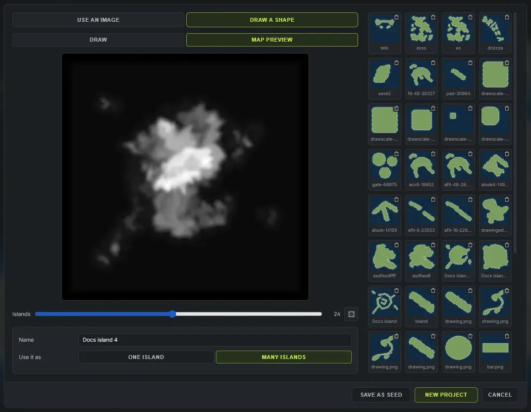
Picking Many islands switches the square to its Map preview tab, which is the real generated map at full size rather than a sketch, so you can see where the water between the islands lands before you commit. Tab flips between Draw and Map preview, and the square never changes size when you switch.
Under the preview: an Islands slider, from 2 up to 48, the same limit as a full multi-island map, and Re-roll, which keeps the same shape and the same count but rolls the islands again, changing their mountains, rotation and coastlines.
The count changes how many pieces your shape is made of, not how much of it survives:
- A low count gives a few large landmasses. The shape is approximated broadly, and neighbouring pieces often join into one continent split by a strait.
- A high count traces the outline much more closely, so arms, spits and separate lobes all come through as their own islands.
On the Use an image tab there is no drawing pad, so the count, the re-roll and the map preview sit beside the picture as thumbnails instead.
Making the map
Section titled “Making the map”Give the shape a name, then:
- New project clears the map and builds a fresh one from your shape.
- Save as seed does the same and also saves it to your seeds, so you can come back to it or share it.
If a button is greyed out, hover it and it will tell you why.
Conjuring afterwards keeps your outline: it rolls a fresh set of islands inside the same shape rather than throwing it away.
Every shape you accept is kept in the library on the right of the panel. Click one to open it back in the pad and keep working on it, or use the bin on its corner to delete it. Two shapes cannot share a name: a name already in use turns the field red until you change it.
What happens to your shape
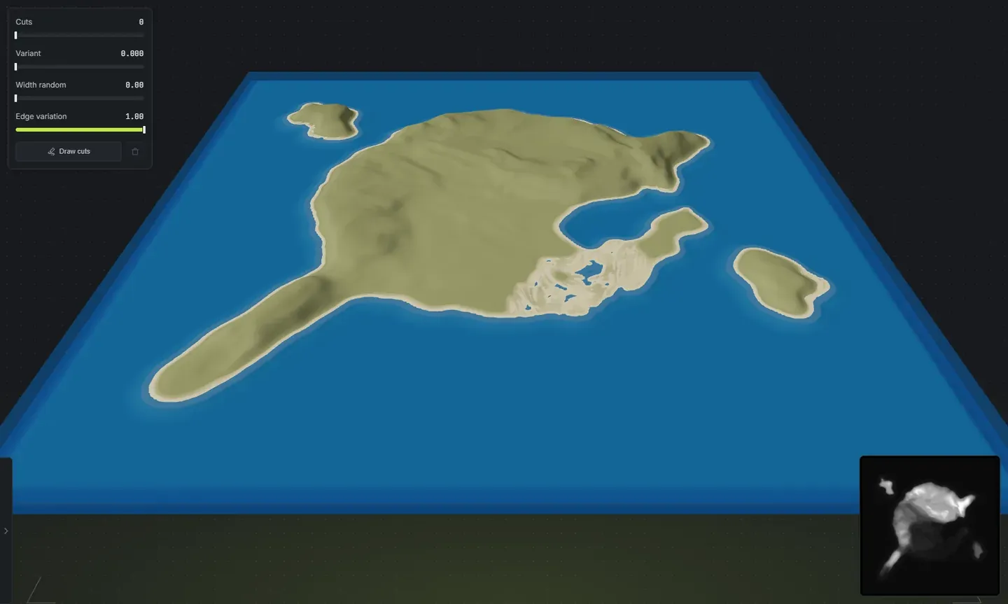
Section titled “What happens to your shape”Your outline decides where the land is. Everything else is still generated: the height, the mountains, the erosion, the beaches, the biomes and splats, the lakes and the cliffs. Every slider in the Generator still works on it, so the same island can be flat and sandy or mountainous and forested.
The coastline you draw is the coastline you get, with the app’s own coastal detail added on top so the shore does not read as a traced line.
Next steps
Section titled “Next steps”- Generate the world so the island gets biomes, splats and topology.
- Cut channels through the shape if you want water running across it.
- Paint biomes and splats by hand where you want something specific.
- Export a .map file and open it in RustEdit.